We were sorry to leave the Cody area, but it was time to move on. We had no reservation for our next stop, which was on the other side of Yellowstone, so wanted to get there about the time folks began to leave in order to score one of the walk-up sites. Most public campgrounds have at least a few walk-up sites (not available for reservation) so we left camp just before 6 AM for our 120 mile drive across Yellowstone. (The park loop drive is laid out in a figure eight, with two of the access roads exiting from the top part of the eight, and out from the bottom loop, entrances from the east, west, and south.) The drive would be about two and a half hours and the forecast was 37 degrees and rain with possible slides and flooding later in the day.
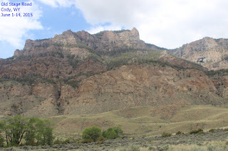
As Rich drove, I was scanning the rocky
cliffs, still hoping for a glimpse of a bighorn sheep when I spotted
some light-colored movement high up the mountain. I whooped (in what
I thought was glee, but Rich thought was fright). I finally managed to verbalize
what I had seen and we stopped for a look. Using the binoculars, we
saw what we thought were two adult and two young bighorn sheep. We
watched for a few minutes and I got some photos and we were stoked. A
s I was working with the photos some time later, I was able to
enlarge them enough to see that they were actually mountain goats,
not bighorn sheep, but since we had no expectations of seeing the
goats, we weren't disappointed.
The drive through the park was,
happily, slide free with little traffic. Although we had seen some
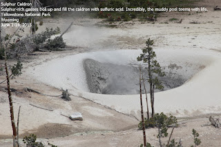
fumaroles on our first foray into the park, we took the opportunity
to stretch our legs when we saw the tell-tale steam rising from a
spot just before a parking area. While Rich was checking tires on our
rig, I walked over to the path to the hot spring. It was around 45
degrees no one else around. As I walked down the path toward the
spring, I heard a hissing sound and the closer I got, the louder the
noise. As I walked around a curve in the path, a big sulphur cloud
swirled past. The air reeked of sulphur and the spring was bubbling
and hissing and spewing foul smelling steam – it was eerie as
can
be. There's a video (admittedly poorly done, since I forgot to take
my tripod...) of the spring, but fortunately, it's not in
“smell-o-vision”.
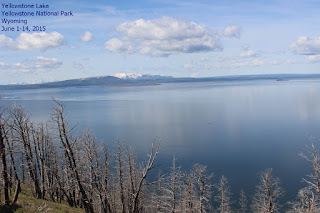
We had another 10 hour day trip on the
17th from the West Yellowstone entrance up to the entrance
at Mammoth Hot Springs and back. Superlatives elude me as they did
our previous day in the park and I'll let the photos speak for
themselves. Suffice it to say, it's awe-inspiring and while some
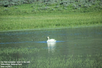
parts have a soft beauty about them (the lake with the trumpeter
swans), and others rocky piles of broken-down mountain (sheep eater
cliff), and yet others are noxious, bubbling springs that threaten death nestled amid some of the most beautiful sights I've ever seen. It's all amazing in its own way.
June 18 Wolf & Grizzly Discovery
Center
The next day we went to the Wolf and
Grizzly Discovery Center in West Yellowstone, an AZA accredited,
not-for-profit wildlife park and educational center. There are eight
grizzly bears, six wolves, and a number of birds of prey that call
the center home. All have had to be removed from the wild for their
own safety. Some will be rehabilitated and returned to the wild,
others will live out their lives at the WGDC. There is a large bear
habitat into which one grizzly at a time is moved after young
volunteers helped park workers hide appropriate treats under rocks,
logs, and other natural features. The bears are also used in product
testing “bear-proof” products. A large display of damaged and
destroyed coolers and garbage cans attest to the strength and
ingenuity of the grizzlies.
There are three wolf habitats for the
three wolf packs. The day was already well on its way to the
mid-eighties, so the wolves were making themselves scarce and we
weren't able to watch them.
There are informative videos, a fairly
large museum, and eleven different talks on a variety of interesting
topics – many geared toward teaching children about respecting and
enjoying nature. The
center is undergoing a large expansion –
adding a riparian habitat for river otters and we plan on returning
the next time we're in the area.
While the Discovery Center was a great
experience, lunch at the number two rated food spot in West
Yellowstone wasn't. Las Palmitas is food truck, and while we've had
some great, authentic Mexican food at some, this wasn't one of them.
I threw most of my lunch away and Rich didn't finish his. Happily, we
did find Wild West Pizzeria and Saloon – they make a good pizza and
have nice, icy cold beer.
A couple days later we drove up to
Bozeman, MT through the Galatin National Forest. From West
Yellowstone. Bozeman, at 89 miles and an hour and 46 minutes away, is
the closest town with some larger grocery stores, and Rich was ready
to upgrade to a smart phone! (The two grocery stores in West
Yellowstone were adequate in a convenience store way, but we needed
more than that.) The drive was beautiful and we stopped to take a
look at a couple of campgrounds along the way. At Target, we picked
up Rich's new cell phone – even called Consumer Cellular to be sure
we got the right SIM card for it, and (hoped) to ready it for use.
(Long story short – Consumer Cellular strikes
again. In spite of
reading the info on the SIM card package to the CC agent, we ended up
with the wrong card and couldn't get on line or transfer Rich's
contacts. Ended up driving another 100 miles to town for a 3-in-1 SIM
card, as we were instructed to do by CC. After several phone calls
and several days, they finally figured out that once again we had
been told to get an incorrect SIM card, they mailed the right SIM
card. After driving 400 miles, buying two different items, and
numerous calls, we were finally able to get the phone to work
properly. Grr.)
On the 23rd, we headed out
at 6 AM and 35 degrees to Teton National Park, which is through
Yellowstone and south toward Jackson Hole (Mammoth was north).
Believe it or not, there were already cars in line to enter the park.
On the way to Teton, we'll be going past Old Faithful and a couple of
other areas in Yellowstone we have yet to visit, but figure this trip
will give us an idea of where we want to stop on our next visit.
The trip through Yellowstone was, of
course, amazing. We saw a coyote hunting for food, some great old
cars, and a lot of steam plumes from the Upper and Lower Geyser
Basins, which we'll visit in a couple of days.
John D. Rockefeller, Jr. visited the
area in the 1920's and was dismayed by the haphazard development,
bought up and later donated more than 32,000 acres of the Jackson
Hole Valley to the federal government in order to protect the
spectacular scenery.
Rockefeller played a part in conserving other
national parks including Yellowstone, Yosemite, Acadia, Shenandoah,
and the Great Smoky Mountains.
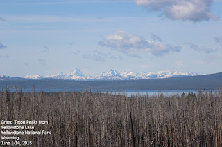
Neither of us was prepared for the
Tetons. As different as night and day from Yellowstone, the Tetons
are huge, dark, rocky peaks that loom over everything within miles –
Grand Teton rises more than 13,700 feet above sea level while
Yellowstone's Eagle Peak is a lowly 11,372 feet! The rocks at the
core of the Teton Range are 2.7
billion years old – some of the
oldest in North America, but the mountains themselves rank among the
youngest in the world. The geologic history of this part of the
country fascinates me.
The drive through Teton was beautiful
with many turnouts for hiking trails and spectacular views, but with
a seven-hour total drive time from camp and back, we drove with an
eye on the clock. As one travels through the park, five diverse
habitats emerge: Alpine, Forests, Sagebrush Flats, Wet Meadows, and
Lakes, Ponds,
and Rivers. It was difficult for me to pay attention to
anything other than the peaks, and I had to remind myself to look
around as well as up.
We stopped at Jenny Lake, a beautiful, peaceful spot, which was
created by rock debris deposited by glaciers around 12,000 years ago.
The lake is estimated at 423 feet deep and as of 2005, still
considered pristine. As you can see, it is beautiful.
 After about five hours in the park, we
headed home through Teton Pass, 8,431 feet above sea level and on
into Idaho. Much of the drive over the pass was a 10% grade, which
made for some picturesque views. We stopped in West Yellowstone to
pick up dinner – a yummy pizza from Wild West Pizzeria and headed
back to camp after another long but amazing day.
We spent the next day in camp – I
baked bread and we restrung the window shades in the RV. It was a bit
confusing, but after the first
 one it went quickly. The following
day, we drove to Idaho Falls (108 miles away) for groceries and a new
iPad for Rich, since his old one had stopped charging. We had great
lunch at Red Robin – the first one we'd ever been to. We had
wonderful burgers and a decadent dessert, chocolate fruffles
-chocolate coated brownie sticks with sea salt and sugar and a dish
of berry ketchup for dipping. We could barely move when we left!
Next stop: Rainbow Point.


