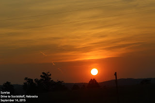
 As usual on a travel day, we were up
and ready to roll by daylight and the sunrise started our day with
beauty – a good argument for getting up early. We traveled miles
and miles without seeing a single vehicle and the scenery was amazing. More broad expanses of pastureland pocked with hidden arroyos,creeks, and occasionally a huge promontory in the distance. I wonder if Indians or mountain men climbed it to survey the area? Imagine crossing this country on foot – these promontories gave the early travelers landmarks to help guide their way. I can't imagine – I get lost using GPS!
There are many things I love about traveling like this, but the big one is never knowing what you'll see in the next minute or hour. This drive was no disappointment although the campground was. As we have found with many county campgrounds that claim to be an rv park, the Riverside RV Park was dismal – few trees, a few Rvs, and lots of sand with little shade. It was only about 10% occupied and of those, most appeared to be long-term residents. There was an added surprise, however, the county zoo was adjacent to the RV park and we were treated to a bored lion's roar throughout the day. The zoo was as dismal as the RV park and although we didn't go through it, the animals didn't seem to have much in their areas to pique their interest. Sad. We decided to stay because it was near Scotts Bluff National National Monument, and as you've no doubt noticed, we enjoy historical sites and I especially like those dedicated to the settlement of the West.
 I had read about Scotts Bluff as a landmark for the emigrants in covered wagons headed west, but that is just the tip of the story. The first humans ventured out onto the High Plains ten thousand years ago. Prior to that, it was all part of the area that was a huge, shallow, inland sea which was displaced when the Rocky Mountains were formed, and fossilized bones of rhinos, camels, giant hogs, and huge turtles have been found in the area. The park visitor's center is packed with wonderful artifacts and information and the rangers there were most informative, as is almost always the case. The emigrants on the Oregon Trail would have traveled nearly 6,000 miles by the time they reached Scotts Bluff – one of the landmarks they undoubtedly looked forward to. By this time, they would have become hardened to the 15 or so miles of walking a day, and making and breaking camp. Here they could rest in the shelter of the bluffs, mend clothes, tack, and wagons, and prepare for the next 1,500 or so miles.
We drove to the top of the bluff one morning and from there, could see Chimney Rock, just 23 miles east. We drove there that afternoon in 29 minutes – it would have taken the emigrants two days. Chimney Rock, while an arresting sight, was far less impressive than Scotts Bluff although the visitor's center had a huge quantity of books, displays, and other information. The first sign we came upon warned us of rattlesnakes, but it got better after that.
 There were many excerpts from journals and diarys kept by emigrants; here are a few I found interesting:
“The Daily Routine
 Our system of travel is thus: The whole encampment is roused by the sound of a trumpet at or before sunrise. Breakfast, which hitherto has consisted of bread, fried bacon, and coffee, is prepared and discussed as soon as possible, usually by six o'clock, when the morning cattle-guard is summoned to drive the oxen into the corral prepratory to 'catching up' or yoking. This occupies an hour or more, and at seven or half-past seven, our march commences. "Between 12 o'clock and one o'clock the train is halted in rhe road for the oxen to breathe. There is a delay of an hour, during which each person partakes of such refreshment as has been provided before leaving camp in the morning. The march is then resumed, and continued according to circumstances in reference to grass, water, and wood until 5 or 6 o'clock in the afternoon, when our corral is formed, our tents pitched, and our evening meal provided. "
“These Platte Sioux are the best Indians on the prairies. Look at their conduct during the past summer. Of the vast emigration, which rolled through their country this year, not a person was molested, not an article stolen. Such good conduct deserves reward."
We had an empty cracker box which we made answer for a coffin, dug a grave in the middle of the road and deposited the dead child therein... We filled the grave with stones and dirt, and when we rolled out drove over it. Perhaps we had cheated the wolf by doing so – perhaps not. John Clark, who in 1852 six days from St Joseph helped bury a child.”
 “After getting into the [North Platte] valley we found two large towns of Indians who met us in great numbers and were very friendly. We camped between those two villages of red men. And immediately on getting into camp we were visited by some three hundred Indians with Whirlwind at their head who presented us with his papers stating that he was friendly and was the emigrants' friend. We felt pretty safe here..."
Walter Pigman, 1850
 “More emigrants along the Platte Valley shot and killed one another (most accidentally) than were killed by natives. Indians almost never attacked encircled wagon trains as popularized by movies and on television.”
 Graves of at least 20,000 victims littered the trail, with at least twenty named individuals buried in the Chimney Rock area. Many fatalities came from the deadly killer Asiatic cholera. Most accounts blamed ill health on bad water; at the time people were unaware of the dangerous microorganisms thriving in it."
 Many other heartbreaking and heartwarming stories were, told within the visitor's center. I can't imagine embarking on such a journey. I can only think that life must have been even more difficult back East, but I have read about families who, once arrived in Oregon, turned around and returned.
While we were happy to leave the campground, but the visit to Scotts Bluff was a special stop.
Now we're on to Alma, Nebraska.


