 We left Hardin around 9:30 AM – we
only had a couple of hours to travel but since we didn't have a
reservation, wanted to get there around noon. The drive was easy and
the scenery beautiful. Because of all the smoke in Hardin, we had
called the Ranger Station to be sure there weren't any fires in the
area even though they were occasionally getting smoke from the
Montana fires. We stopped at Sheridan, the nearest town of any size
(17,400 population) on the way to Sibley Lake, for groceries, then
headed toward the mountains. Once we left I-90, the scenery grew more
and more impressive. I've read about “scenery unfolding” and the
author must have been talking about Wyoming. It seems that the
landscape changed by the second. A big part of that change was in
elevation – Sheridan is at 3,743 feet and our campground at 7,900
feet, and much of the highway near the campground was at 10,000 feet,
but there are peaks in the Bighorn Mountains that reach 13,000 feet.
What a view!
We arrived at the campground around 11
AM and the temperature was in the mid-60's – a drop of 20 degrees
from Sheridan. We lucked into a walk-up site with both electricity
and water – the only one with electricity left and one of the very
few that had water on the site! We talked to some folks who had been
there overnight and they told us they had snow flurries that morning.
Our first morning at 7 AM it was 28 degrees – believe me when I
tell you pit toilets are cold at that temperature!
There is an amazing amount of history
here - the campground was named for a Lt. Frederick Sibley, leader of
a scouting party that was attacked by a party of Sioux and Cheyenne
in 1876. There is also a 39 foot by 500 foot earthen dam built by the
Civilian Conservation Corps in 1937.
After talking with some fellows at a
construction site, who told us about some beautiful
off-the-beaten-path drives and hikes, we set out to find a forest
road map. After driving through the forest at Mt. Hood, we learned it
was a necessity, since many paved roads dwindle down to one-lane,
rut-filled paths and twist and turn until finding your way back where
you started is a real challenge. To that end, we drove down the
mountain and had good breakfast at the Branding Iron in Dayton. We
never did find a road map, but we did manage to do some exploring
without getting too lost :)
Dayton is a pretty little town of 780
inhabitants, with a convenience store/gas station, a couple of
antique shops, a post office, gas station, library, the cafe, and not
much else, but it was about 30 miles closer than Sheridan. We made
several trips down the mountain – sometimes just partway down for
cell and data service and sometimes for milk, eggs, breakfast, fuel,
or the post office. Diesel is about 20 cents less than at the towns
nearer the interstate – it seems as though everyone around here has
a 4-wheel drive vehicle and for good reason. Many of the forest roads
are rough and difficult to navigate in good weather, but add rain or
snow? And I can't imagine what some of the driveways must be like in
the winter – not to mention the roads.
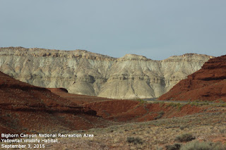
About 500 million years ago, it was
much warmer and seas covered all of Wyoming. About 75 million years
ago, the earth's crust began to grind together, the earth buckled and
heaved, and the Bighorn Mountains were born. They are relatively
young at 70 million years (the oldest in the world is a range in
South Africa at 3.5 billion) but some of the rock formations in this
part of the Rocky Mountains are the oldest we've noticed at 2.5
billion years. The long, sharp, red ridges are called “hogbacks”.
No matter how many times we drove up and down, we found the scenery
looked different depending upon sunlight and shadows.
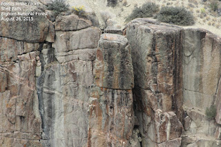
Shell Falls
One morning, we packed a lunch and
headed out to Shell Falls (named for the shell fossils found in the
sedimentary canyon walls), about an hour's drive from camp. The
falls, over the past million years, has cut a deep chasm through the
sedimentary stone and ancient granite. The water of the falls,
dropping at a rate of 3,600 gallons per second (enough water for 144
showers every second if flows), follows fractures in the resistant
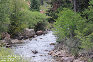
granite. In the basin west of the Bighorn Mountains, average
precipitation is less than 10 inches of rain and snow annually. Shell
Creek, however, is an oasis in this otherwise arid land – receiving
20 – 23 inches of precipitation throughout a year. Shell Falls is
considered the “thundering heartbeat of the Bighorn Mountains”.
There is a beautiful visitor center, chock full of information and
fossils, and an interpretive nature trail that winds around the area
giving wonderful views of the falls, the creek, and the canyons.
We spent the next several days washing
and waxing the RV and truck and went back to Sheridan for groceries
and other errands after a good breakfast at the Branding Iron. While
we were there, we had lunch at Las Delicias, a Mexican restaurant.
What was missing in ambiance (a lot) was more than made up for in
their wonderful pork green chile! We had a package to pick up at UPS
where we saw a beautiful stag standing in the middle of the road,
then found a grocery store and stocked up on groceries.
Drive to Lovell, Cody, and Graybull
What a beautiful drive! I told Rich I
believe my one big regret is that I wasn't able to come out here 20
or more years ago. I love Utah, but this feels like home. This drive
just reinforces that feeling. I wish you could see it for yourself.
We left camp about 8 AM and headed for Lovell.
The drive begins at about 7,900 feet
above sea level – the weather is cool (August 31 and it was 36
degrees this morning and not supposed to get above 60) this far up in
the mountains and most of the drive is 5,000 feet and often 10,000
feet. It is high desert here with evergreen forests scattered
throughout. Much of the first part of the drive is free range, so
cattle reign here and may face you down in the middle of the road.
Happily, we didn't have any problems.
The road to Lovell has a 13 mile
section with 10% grade that dropped 3,600 feet and had warning signs
conspicuously posted at the beginning and throughout the worst of the
grade. The view was amazing and we stopped in several pull-outs so
Rich could appreciate the breathtaking view.
As we drove toward Lovell and
descended, smoke from the Washington-Oregon-Montana fires was more
and more noticeable, but the scenery was still spectacular. We
stopped in Lovell at the Pryor Mountain Wild Mustang Visitor Center
and talked to a delightful and incredibly knowledgeable woman who
gave us a lot of information about the history of the horses who have
lived in this rugged area for about 200 years. We have to find time
to visit the horses before we leave the area!
As we continued to Cody where we had
lunch and did some shopping, the scenery changed again to mostly high
desert. Near water sources, we saw acres and acres of sunflowers and
fields of what I think was Swiss chard or some other leaf vegetable.
The mountain peak looming above everything nearby is, I believe,
Granite Mountain as seen from several sides. It is the highest
natural point in Montana at over 12,700 feet above sea level and is
about 55 miles away. Cody wasn't as busy as it was when we were there
in June – school is about to start and tourists have headed home. I
liked it better today. While we were in Cody, we picked up some
grocery items that aren't available in Dayton or Sheridan, had a good
lunch at Adriano's Italian Restaurant then headed out again.
The drive from Cody to Graybull was
uneventful, with more high desert scenery, as is much of the Graybull
to camp but it was the most memorable. About 20 miles from camp we
were driving at about 60 mph when we spotted what Rich thought at
first was a coyote, but as we got closer, we mentioned it moved more
like a cat and was larger than a coyote. I quickly snapped off four
photos, never expecting to have been successful, but to my delight, I
spotted the animal in the first of the four photos! I enlarged it and
found it was a mountain lion! What amazing luck – first to see one
at all and second to have actually gotten a photo of it from about
100 yards while it was running across the road and we were traveling
at 60 MPH! When we arrived back in camp and I transferred the
pictures to the computer and looked more carefully, I found that I
had a mountain lion in all four shots and one actually shows a second
cat. I was ecstatic, especially when I showed it to a ranger who had
lived in the area and she told me she'd never seen one much less two.
How very lucky we are and what a great finale to a wonderful day!
We spent one afternoon walking over to
the far side of the lake, then back to the beaver dam we saw and
hoped to see a beaver. We were lucky again and saw not one but two
beavers! The next day we spent several hours at the library, using
their wi-fi and catching up on email.
Pryor Mountain Wild Horse Range
We were up bright
and early the next morning – we were headed to Pryor Mountain to
look for wild mustangs. After years and heaven knows how many miles
of searching, what should we see shortly after starting out? A moose!
Wa-hoo! We spent about 20 minutes watching him before we got back on
our way to Pryor Mountain. Once again we went down the road with the
10% grade, enjoying the views as much as the first time, and reached
Lovell about an hour later.
The Pryor Mountain Wild Horse Range is
a refuge for the historically significant herd of free-roaming
Mustangs, feral horses, located on a 38,000 acre tract that straddles
Montana and Wyoming. This isolated area is home to approximately 230
wild horses whose history, conformation and genetics show that they
are descended from the horses brought to the New World by the Spanish
Conquistadors. Due to the area's natural barriers and isolation, the
horses have retained their original characteristics for an estimated
200 years. Many of these horses are still gaited! In looking at
photos of some of the horses, striped legs and a stripe down the
backbone, markings indicative of their Spanish antecedents, were
visible. In order to preserve these special horses, the Pryor
Mountain Wild Horse Range was established in 1968 as the first public
wild horse refuge. As with many other wild animals, good management
is essential to preserve and protect the species. The woman we
visited with at the center told us an auction is under way on the
internet to adopt out a number of young wild mustangs to private
parties. The dollar amounts bid range from about $500 to nearly
$2,000 and the auction is not over. The winners of the auction
undergo stringent investigation and do not receive ownership papers
on the horse for a year after purchase and an inspection of the horse
and facilities. Equine geneticist Dr. E. G. Cothran concluded that
“the Pryor herd may be the most significant wild-horse herd
remaining in the United States.” The horses have been verified by
DNA analysis to be descended from the original Colonial Spanish
Horses brought to the Americas by the Spanish. Genetic studies have
shown that there is a low degree of inbreeding. We spent several
hours driving, seeing the beautiful area and hoping for a glimpse of
some of the horses. Rich spotted a small band a short way into the
range and although I didn't see them, one picture I snapped in their
direction clearly shows three of the band. We saw miles and miles of
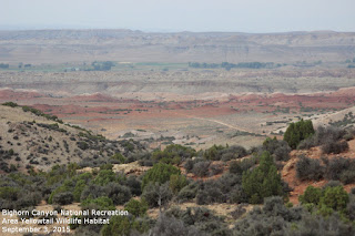
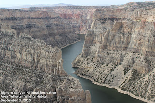
beautiful scenery, canyons, and Indian camp areas. This area has had
families living here for 10,000 years and the ancestors of the Crow
have been in the area for 1,200 of those years. Charcoal from
campfire circles date back 2,000 years in some parts of the Bighorn
Canyon area.
About the time we realized we were
nearly back to the beginning of the range and wouldn't be seeing any
horses, we came upon a small band of them – the stallion walking
down the middle of the road, owning it, and the rest of the band off
to the side. Of course, as usual with animals, most of the photos I
got were of their backsides, but we saw them and that was special. We
went back to the visitor center and spoke to the same woman we saw
earlier and after downloading my photos to her computer she was able
to identify the band as Hidalgo's. They were beautiful to watch and
we're planning on returning in two years and camp in the canyon so we
try to spot other bands. We talked to a mother and daughter who had
camped there for a week and they hadn't seen any horses, so we were
luckier than we knew. I wonder if I can talk Rich into renting an ATV
while we're there?
Our time at Sibley Lake was over long
before we were ready to leave and since we've had such a great time
here, we decided to move to Prune Creek Campground, just down the
road for an additional week.














No comments:
Post a Comment